
Commonwealth Avenue
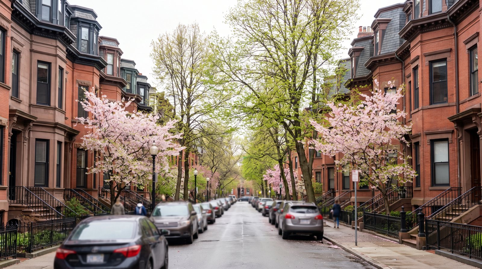
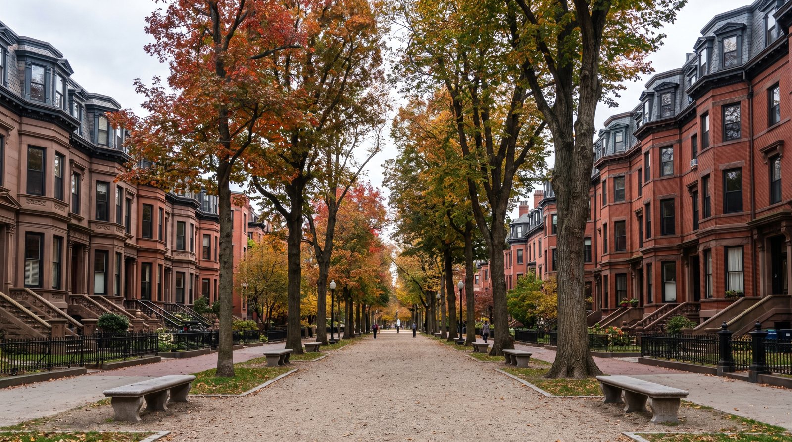
Commonwealth Avenue's Back Bay stretch runs nine blocks from the Public Garden at Arlington Street to Charlesgate East: a 200-foot boulevard split by a 100-foot central Mall, lined with houses on the deepest lots in the residential grid (124.5 feet).
Beacon Street
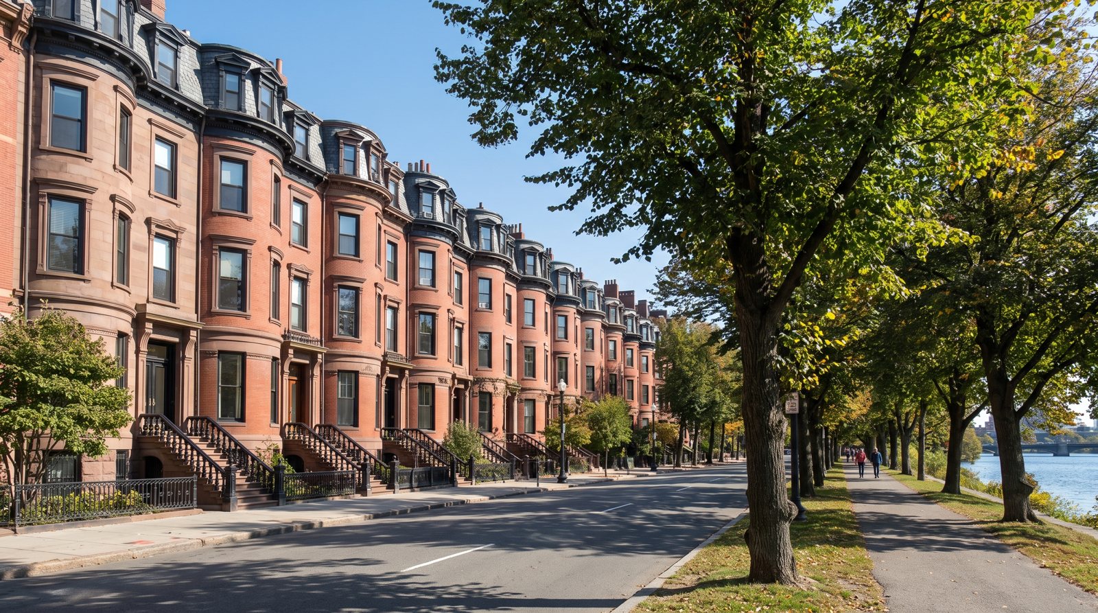
In the Back Bay, Beacon Street runs nine blocks from Arlington Street to Charlesgate East along the line of the 1814 Mill Dam, with house numbers from about 100 to 535.
Marlborough Street
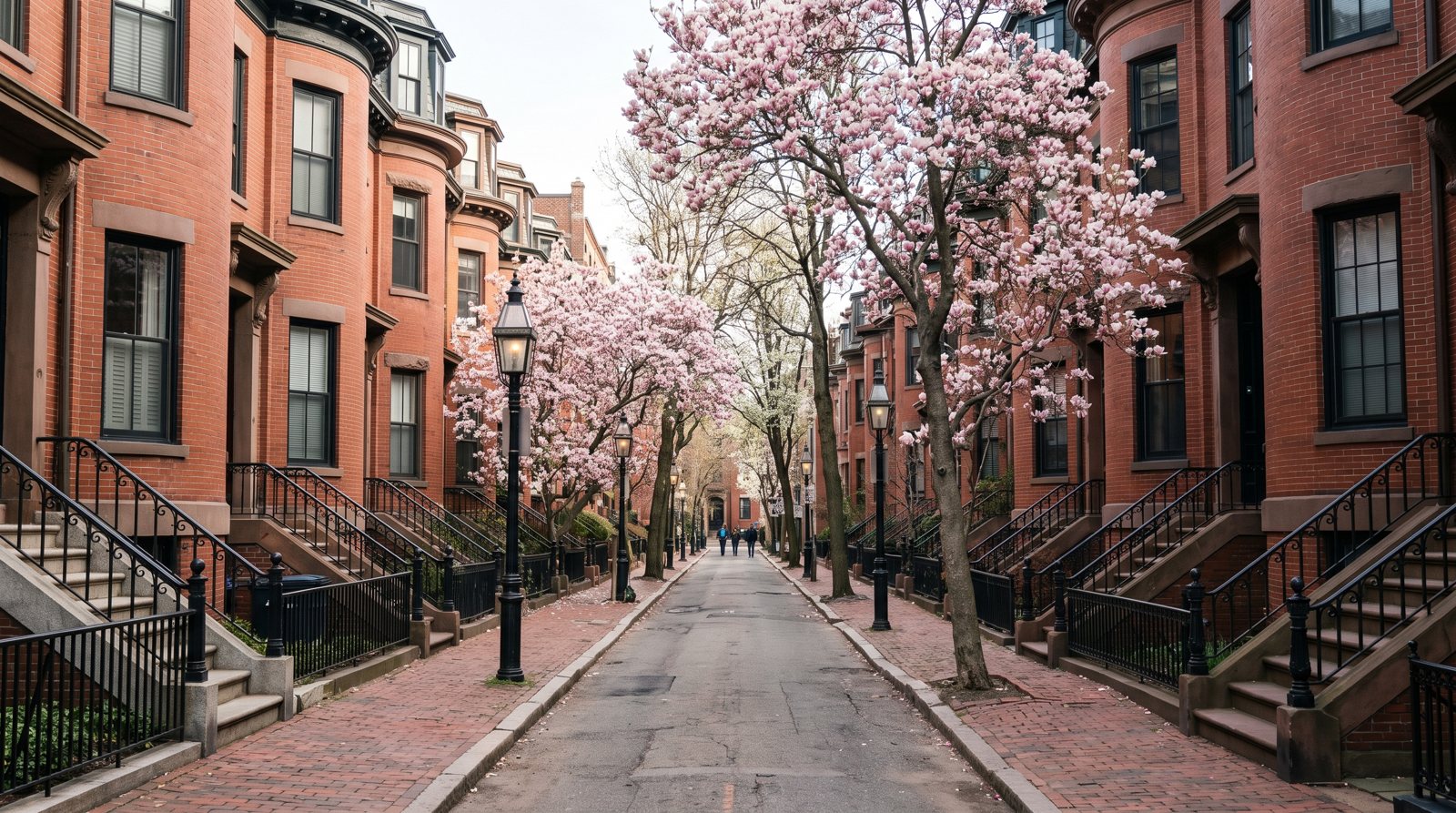
Marlborough Street is the Back Bay's 60-foot residential street between Beacon Street and Commonwealth Avenue, running nine blocks from Arlington Street to Charlesgate East with house numbers from 1 to about 459.
Newbury Street
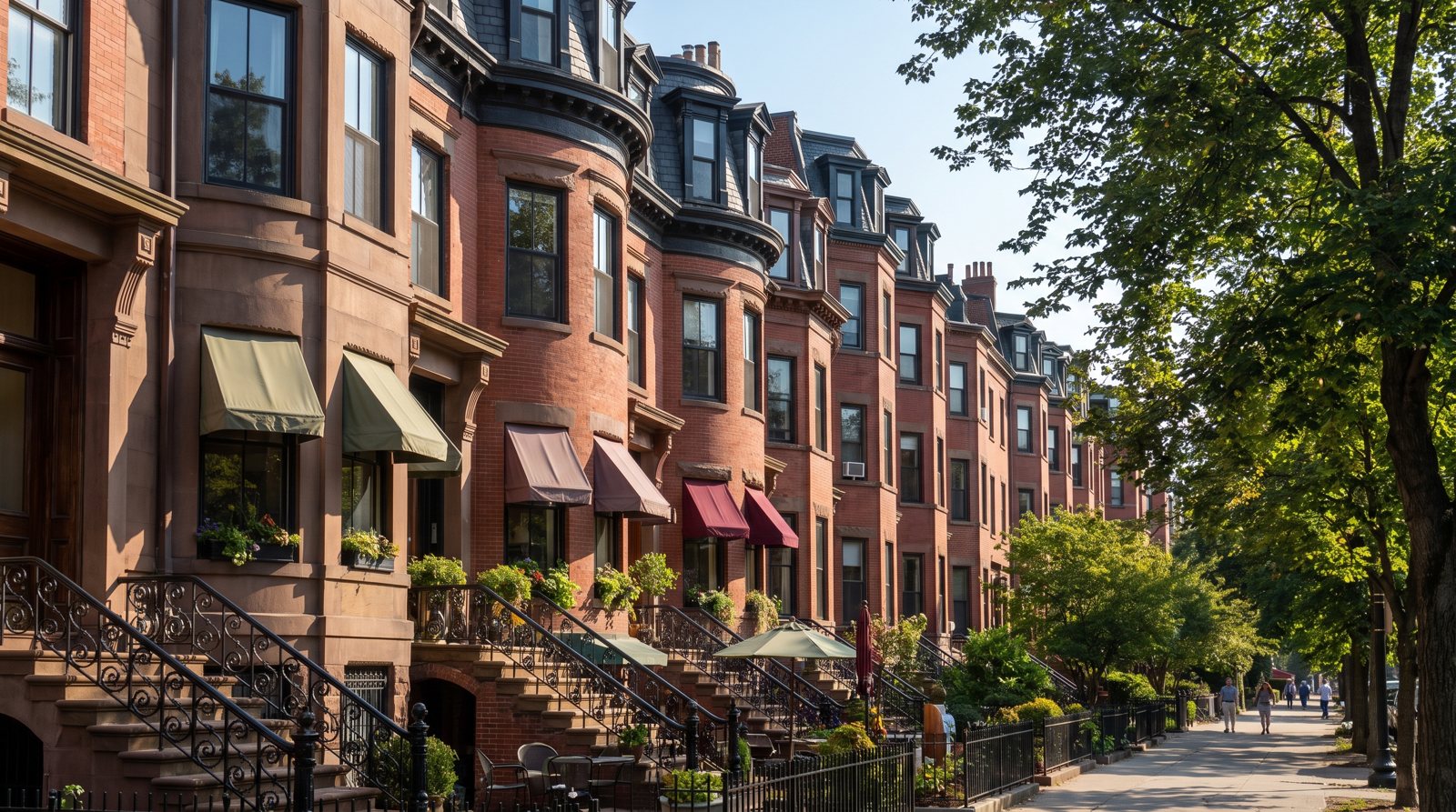
Newbury Street is known for its retail shops and restaurants, which fill about a mile of 19th-century buildings east of Massachusetts Avenue, but many of those buildings still hold homes, typically condominiums on the upper floors.
How are Back Bay streets laid out?
The Back Bay is a planned grid on filled land. The 1856 plan, largely credited to architect Arthur Gilman, set five east-west streets (Beacon, Marlborough, Commonwealth, Newbury and Boylston) and crossed them with north-south streets named in alphabetical order: Arlington, Berkeley, Clarendon, Dartmouth, Exeter, Fairfield, Gloucester and Hereford. Beyond Hereford come Massachusetts Avenue and, at the western edge, Charlesgate East. Behind each row of houses runs a 16-foot alley, which kept delivery wagons off the main streets.
Homes are concentrated on the three northern streets, Beacon, Marlborough and Commonwealth, and on the cross streets between them. The City treats everything north of the alley between Commonwealth and Newbury as the residential portion of the Back Bay Architectural District, and Newbury and Boylston as the commercial portion. Back Bay Houses counts 1,156 buildings built on the originally vacant lots of that residential area; how the land was filled and built is covered in our history of the Back Bay.
Zillow publishes no street-level values. For the main Back Bay ZIP, 02116, its typical home value in August 2026 was $1,355,771 for all homes, $1,298,982 for condos and $1,818,983 for single-family homes. ZIP 02199, around the Prudential Center, is dominated by towers and does not describe brownstones; the Back Bay ZIP code guide explains the split.
Back Bay streets compared
Widths are from the 1856 plan, lot depths and setbacks from the original deed restrictions, as recorded by Back Bay Houses. Every street in the table lies inside the Back Bay Architectural District.
| Street | Planned width | Lots and setback | Homes today | Setting | Value reference |
|---|---|---|---|---|---|
| Beacon Street | 70 ft | 20 ft building line both sides (1895); south-side lots 112 ft deep | Condos in former houses; some single-family | Oldest houses (1856 to 1857); north side backs toward the Esplanade | Zillow ZIP 02116 |
| Marlborough Street | 60 ft | 112 ft lots; 22 ft setback both sides | Condos in former houses; some single-family | Residential street between Beacon and Commonwealth | Zillow ZIP 02116 |
| Commonwealth Avenue | 200 ft, with a 100 ft Mall | 124.5 ft lots; 20 ft setback | Condos, single-family houses, 1890s apartment houses | Faces the 32-acre Mall | Zillow ZIP 02116 |
| Newbury Street | 60 ft | 112 ft lots; 22 ft setback | Condos above shops in mixed-use buildings | Commercial portion of the district; shops and restaurants | Zillow ZIP 02116 |
| Boylston Street | n/a | Original setback 22 ft north side, 25 ft south side | Mostly commercial and institutional | Copley Square, Trinity Church, Central Library | 02116; Prudential frontage 02199 (towers) |
| Cross streets, Arlington to Hereford | Arlington 80 ft; others n/a | No front setback requirement | Corner buildings and side-street homes | Link the east-west streets; Arlington faces the Public Garden | Zillow ZIP 02116 |
| Massachusetts Avenue to Charlesgate East | n/a | Filled and built from the early 1880s | Houses and larger apartment buildings | Western edge at the Back Bay Fens | Check the ZIP by address |
The five east-west streets
Beacon Street
Beacon follows the line of the 1814 Mill Dam, and its Back Bay blocks run from Arlington Street to Charlesgate East, numbered from about 100 to 535. The first Back Bay houses were built on its north side between Arlington and Berkeley in 1856 and 1857. North-side houses back onto Back Street, the edge of the historic district, and beyond it the Esplanade. See Beacon Street's Back Bay blocks for a block-by-block guide.
Marlborough Street
Marlborough was planned 60 feet wide with 22-foot setbacks on both sides and 112-foot lots, the narrowest of the three residential streets. It is residential from end to end, with alleys behind both sides. Only seven private stables were ever built on the 112-foot blocks, all on the alley it shares with Beacon. More on the Marlborough Street page.
Commonwealth Avenue
Widened on the plan from 120 to 200 feet, Commonwealth has two roadways either side of a 100-foot Mall, a 32-acre park running from the Public Garden to the Fens. Its lots are the deepest in the grid at 124.5 feet, and the 1890s apartment houses and apartment hotels went up mostly here and at the western end. Deeds barred shops on the avenue. Read the full Commonwealth Avenue guide.
Newbury Street
Planned as a 60-foot residential street, Newbury is now known for its retail shops and restaurants, which fill about a mile of 19th-century buildings east of Massachusetts Avenue. Homes here sit on the upper floors of mixed-use buildings. The Newbury Street homes page covers what that means for an owner.
Boylston Street
Boylston is the southern edge of the Architectural Commission's jurisdiction and the Back Bay's main commercial and civic street. Copley Square sits on it, with Trinity Church (built 1872 to 1877 to H. H. Richardson's design) and the Boston Public Library's Central Library at 700 Boylston, in its McKim building since 1895. The Prudential Center's Boylston entrance, at 800 Boylston, uses ZIP 02199. Original setbacks were 22 feet on the north side and 25 on the south.
The cross streets, Arlington to Hereford
The north-south streets had no setback requirement, so their corner buildings and side-street houses sit differently from the east-west rows. House-number ranges below come from the Back Bay Houses block indexes.
Arlington Street
Created 80 feet wide in front of the Public Garden under the 1856 agreement, which also added about 2 3/4 acres to the Garden. Houses at this end face America's first public botanical garden. Arlington station, at Boylston, serves all four Green Line branches, and the Arlington Street Church, designed by Gilman and built 1860 to 1861, stands at the same corner.
Berkeley Street
The blocks between Arlington and Berkeley are the oldest in the Back Bay; the Gibson House museum, a Second Empire house of brownstone and red brick, is on Beacon here. Emmanuel Church, one of the first two Back Bay churches, is on Newbury near Arlington. A Bluebikes dock stands at Boylston and Berkeley.
Clarendon Street
Clarendon crosses Beacon at roughly the 180s to 200 range, Marlborough near the 90s to 100s and Commonwealth near the 90s. A Bluebikes dock stands at Clarendon and Newbury.
Dartmouth Street
The Back Bay's transit spine. Copley station is at Boylston and Dartmouth, Back Bay station at 145 Dartmouth serves the Orange Line, four Commuter Rail lines and Amtrak, and the Logan Express stops at the Copley Place entrance across from it. Bluebikes docks are at Dartmouth and Newbury and at Copley Square.
Exeter Street
Exeter marks the middle of the grid, where Beacon numbers reach the high 200s and Commonwealth the 190s. A Bluebikes dock stands at Boylston and Exeter.
Fairfield Street
Around Fairfield, Beacon numbers are in the 330s and 340s. Building across this part of the grid slowed after the 1872 fire and the 1873 panic, and the Commonwealth halted its land sales from 1872 to 1879. A Bluebikes dock stands at Boylston and Fairfield.
Gloucester Street
Boston's first conversion of an existing residential building into condominiums took place in a Gloucester Street building in November 1969. Back Bay Houses calls condominium conversion the most important innovation in keeping the original buildings in use as homes.
Hereford Street
The last of the alphabetical streets. Between Hereford and Massachusetts Avenue, the north side of Newbury was originally planned for residents' stables. A Bluebikes dock stands at Newbury and Hereford.
Massachusetts Avenue, Charlesgate and Bay State Road
Massachusetts Avenue
Called West Chester Park until 1894, it marked the limit of filling in 1881. West of it, Commonwealth Avenue bends northwest, parallel to the old Boston and Albany Railroad. Hynes Convention Center station, at 100 Massachusetts Avenue, serves the Green Line B, C and D branches, and the Orange Line's Massachusetts Avenue station lies at the southern edge, with a 02118 address.
Charlesgate East
Called Ipswich Street until 1887, Charlesgate East is the western boundary of both the residential Back Bay and the Commission's jurisdiction. Beyond it are the Back Bay Fens, laid out by Frederick Law Olmsted from 1879 and now largely hidden by the Bowker overpass of 1966. The Olmsted firm extended the Commonwealth Avenue Mall to Charlesgate in 1885.
Bay State Road
Bay State Road runs west from Charlesgate, outside the Back Bay Architectural Commission's boundary and outside the Back Bay Houses index this site relies on. Our sources do not cover its history or design rules, so before buying there, confirm with the City's Landmarks Commission which review applies and check the ZIP with the USPS lookup.
Which Back Bay street for what
The streets differ in home type, setting and outdoor space more than in anything else. The figures below are Zillow ZIP 02116 values for August 2026; they are not street prices.
For a whole townhouse
Commonwealth Avenue has the deepest standard lots, 124.5 feet against 112 on Marlborough and the south side of Beacon; the north side of Beacon also has deeper lots, which is why most private stables were built there and on the avenue. Single-family houses are a minority on every street. Zillow's single-family figure for 02116 was $1,818,983; see Back Bay townhouses for what drives the price of a whole house.
For a condo in a converted house
All three residential streets offer floor-by-floor condos in former single-family houses, from garden levels to top-floor units. The 02116 condo figure was $1,298,982. The guide to Back Bay brownstone condos covers unit types, fees and documents.
For a park or river at the door
Commonwealth Avenue faces the Mall; Arlington Street faces the Public Garden; the north side of Beacon backs toward the Esplanade, which runs three miles along the Charles; and Charlesgate leads to the Fens.
For a roof deck or private outdoor space
Any street can have a roof deck, but each needs Commission approval: decks must be minimally visible from any public way, set back to the inward edge of the chimneys, with iron railings. Check what is already approved before you pay for one; our brownstone renovation guide explains the process.
For living among shops
Newbury, and to a lesser degree Boylston, put homes above shops and restaurants, in the commercial portion of the district with its own design guidelines.
For transit and parking
Homes near Dartmouth Street are closest to Back Bay and Copley stations; the east end is closest to Arlington station and the west end to Hynes. Parking is scarce on every street: City resident permits are free, but a private space is a separate asset, and a 2024 Boston Globe report described alley spaces trading for hundreds of thousands of dollars. See parking in the Back Bay.
If you own on any of these streets, our recommended agent for Back Bay brownstones can give you a private price based on recent sales on your street and floor; start with selling a Back Bay home.
Frequently asked questions
What streets are in Back Bay, Boston?
Back Bay's grid has five east-west streets, Beacon, Marlborough, Commonwealth Avenue, Newbury and Boylston, crossed by eight streets in alphabetical order: Arlington, Berkeley, Clarendon, Dartmouth, Exeter, Fairfield, Gloucester and Hereford. Massachusetts Avenue and Charlesgate East complete the western end. Homes are concentrated on Beacon, Marlborough and Commonwealth, while Newbury and Boylston are mainly commercial.
Why are Back Bay cross streets in alphabetical order?
The 1856 plan for the filled Back Bay named its north-south streets in alphabetical order, A to H: Arlington, Berkeley, Clarendon, Dartmouth, Exeter, Fairfield, Gloucester and Hereford. The order makes it easy to tell how far west you are. Beyond Hereford come Massachusetts Avenue, called West Chester Park until 1894, and Charlesgate East, called Ipswich Street until 1887.
What are some of the most famous streets in Boston?
In the Back Bay, the best-known streets are Commonwealth Avenue, with its 32-acre Mall listed by the National Park Service as an Olmsted-designed landscape; Newbury Street, known for its retail shops and restaurants; Beacon Street, which follows the 1814 Mill Dam; and Boylston Street, home to Copley Square, Trinity Church and the Boston Public Library's Central Library.
What to do in the Back Bay area of Boston?
Within a few blocks you can walk the Commonwealth Avenue Mall, visit the Public Garden, America's first public botanical garden, follow the Esplanade along the Charles, see Trinity Church and the Central Library in Copley Square, tour the Gibson House museum on Beacon Street, or shop on Newbury Street. Walk Score gives the Back Bay a Walk Score of 97.
What are the boundaries of Back Bay?
The Back Bay Architectural Commission's jurisdiction is a practical definition: it runs to the centerlines of Back Street on the north, Embankment Road and Arlington Street on the east, Boylston Street on the south and Charlesgate East on the west. Other definitions, such as ZIP codes or the City's neighborhood maps, draw the lines differently.
Which is the widest street in Back Bay?
Commonwealth Avenue, at 200 feet, including a 100-foot central Mall. It was proposed at 120 feet and widened on the 1856 plan. Arlington Street was laid out 80 feet wide, Beacon Street 70 feet, and Marlborough and Newbury 60 feet each.
What ZIP code are Back Bay streets in?
Most Back Bay addresses use 02116, including the Public Garden, Back Bay station and the Central Library. The Prudential Center area uses 02199, which is dominated by towers, and the Christian Science Plaza area uses 02115. ZIP and neighborhood lines do not match exactly, so confirm a specific address with the USPS lookup.
Is Back Bay, Boston affluent?
Measured by home values, the Back Bay is one of Boston's highest-priced neighborhoods. Zillow's typical home value for the Back Bay was $1,340,764 in August 2026, compared with $774,723 for the City of Boston, $1,105,539 for Beacon Hill and $1,080,575 for the South End. Single-family houses in ZIP 02116 had a typical value of $1,818,983. Prices still vary widely by street, floor and whether a home is a condo or a whole house.
Sources
- Back Bay Houses: Overview: Development of the Back Bay
- Back Bay Houses: Back Bay Deed Restrictions
- Back Bay Houses: Beacon (address index by block)
- Back Bay Houses: Marlborough (address index by block)
- Back Bay Houses: Commonwealth (address index by block)
- Back Bay Houses: Back Bay Development 1855-1859
- Back Bay Houses: Back Bay Development 1860-1864
- Back Bay Houses: Back Bay Development 1870-1874
- Back Bay Houses: Back Bay Development 1880-1884
- Back Bay Houses: Back Bay Development 1890-1899
- Back Bay Houses: Back Bay Development 1910-2015
- Back Bay Houses: Frequently Asked Questions
- Boston.com: From Landfill to 'Work of Art': Back Bay Architectural District (Feb 5, 2015)
- City of Boston: Back Bay Architectural District
- City of Boston: Back Bay Architectural Commission, Guidelines for the Residential District (PDF)
- National Park Service: Gibson House, National Historic Landmark registration form
- National Park Service: Commonwealth Avenue Mall
- The Cultural Landscape Foundation: Commonwealth Avenue Mall
- City of Boston: Public Garden
- City of Boston: Back Bay Fens
- Esplanade Association: Map and directions
- Wikipedia: Newbury Street
- Trinity Church Boston: History
- Boston Public Library: BPL History
- Prudential Center: Contact Us
- MBTA: V3 API routes for Arlington station
- MBTA: V3 API routes for Back Bay station
- MBTA: V3 API stop Massachusetts Avenue
- Massport: Logan Express Back Bay
- Bluebikes: GBFS station information feed
- Walk Score: Living in Back Bay Boston
- The Boston Globe (via Boston.com): $500,000 for a parking spot? Inside the world of exclusive parking in Boston (May 2024)
- Zillow Research: Home Value Index (ZIP, August 2026)