
At a glance
| Runs (Back Bay) | Arlington Street west to Charlesgate East, house numbers about 100 to 535 |
|---|---|
| Width | Planned 70 feet |
| Building line | 20 feet on both sides, adopted by the City in 1895 |
| Built | First Back Bay houses 1856 to 1857 (north side, Arlington to Berkeley); westernmost blocks from the early 1880s |
| Behind the north side | Back Street, then the Esplanade and the Charles River |
| Historic review | Back Bay Architectural Commission; Back Street is its northern boundary |
What is Beacon Street like in Back Bay?
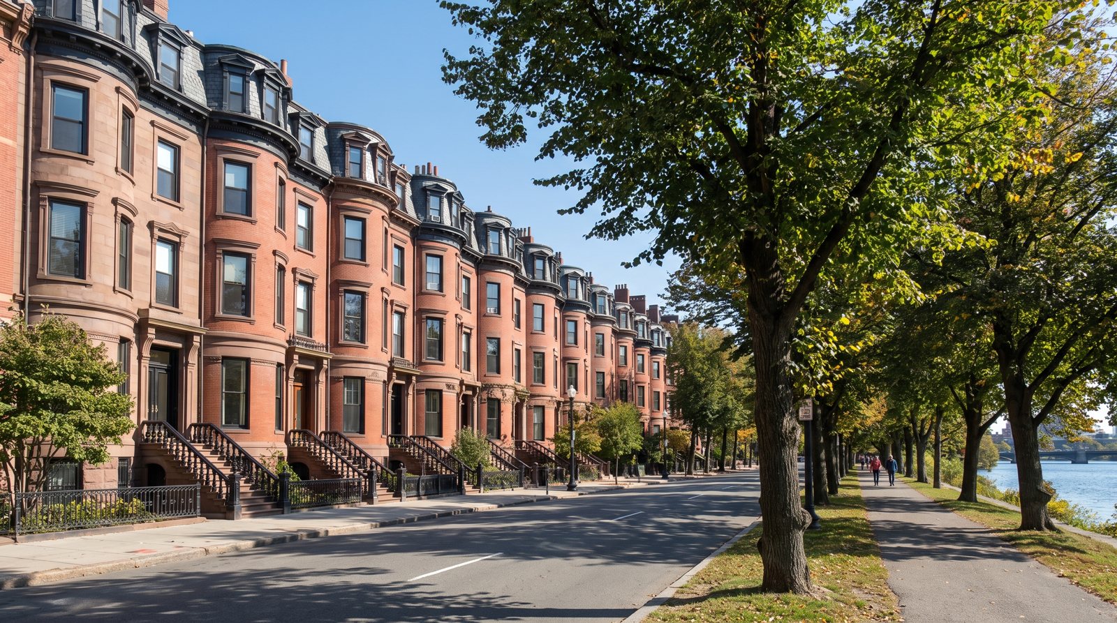
Beacon Street runs through Beacon Hill, the Back Bay and on toward Brookline; this page covers only its Back Bay blocks, from Arlington Street west to Charlesgate East. That stretch follows the line of the Mill Dam, which the legislature authorized in 1814 to hold back the tidal flats of the Charles. The dam road became the western end of Beacon Street, its tolls ended, and the City accepted it as a public way in December 1868.
The two sides of the street have different origins. Land on the north side belonged to the Boston and Roxbury Mill Corporation, while the south side was Boston Water Power Company land filled after 1857. Houses on the north side back onto Back Street, the alley that marks the northern edge of the Back Bay Architectural Commission's jurisdiction, and beyond it the Esplanade. That riverbank was built out in stages: a 100-foot embankment in 1906 to 1908, about 150 feet more for the Storrow Memorial Embankment in 1931 to 1935, and more fill in 1950 to 1951 when Storrow Drive was built.
Beacon was planned 70 feet wide, wider than Marlborough or Newbury, and in 1895 the City adopted a 20-foot building line on both sides. The Esplanade itself runs three miles from the Museum of Science to the Boston University Bridge, with more than five miles of paths and eight footbridges.
Beacon Street homes and prices
There is no Zillow figure for Beacon Street alone. For ZIP 02116, Zillow's typical home value in August 2026 was $1,355,771 across all homes, $1,298,982 for condos and $1,818,983 for single-family homes. Those are ZIP-wide, mid-tier numbers; side of the street, floor and outdoor space move an individual price well away from them.
Condos in former single-family houses
Beacon's houses were built as single-family homes and, like most of the Back Bay, many were later divided into apartments and then condominiums. A typical building holds a few units by floor. Before you offer, ask the trust for the budget, reserve balance and minutes, and order the 6(d) certificate on unpaid condo charges early in the sale.
Single-family houses
Some Beacon houses are still, or again, single-family. The Gibson House museum, on the first block, shows the early form the National Park Service describes: brownstone at the basement and first floor, red brick with brownstone trim above, and a mansard roof. On an owner-occupied whole house assessed at $1,500,000, Boston's FY2026 tax comes to $14,246.26 with the residential exemption, against $18,600 without it; the Boston property tax guide shows how that is worked out.
Houses with rear lots on the river side
Most of the Back Bay's private stables were built behind houses on the north side of Beacon and on Commonwealth, where the deeper lots left room for a separate building at the rear. If a north-side listing includes a rear structure or outdoor space toward Back Street, ask how it is used, whether it is part of the unit or a common area, and what the Commission has approved there.
Beacon Street block by block
Back Bay Houses splits the street into nine blocks. House numbers run from about 100 at Arlington to about 535 at Charlesgate East; ranges below are approximate.
Arlington to Berkeley (about 100 to 147)
The oldest houses in the Back Bay stand on the north side of this block: most were built in 1856 and two were finished in 1857, before the land south of the Mill Dam was filled. The Mill Corporation deeds set a 19-foot setback here, a foot less than further west. The Gibson House museum is on this block.
Berkeley to Clarendon (about 132 to 201)
Across the street from the first houses, the south side was Boston Water Power Company land that had to be filled first; the first houses on the new land south of the Mill Dam went up in the early 1860s. Berkeley Street has a Bluebikes dock two blocks south at Boylston.
Clarendon to Dartmouth (about 182 to 255)
A mid-district block on the river side, where north-side houses back onto Back Street and the Esplanade. Dartmouth Street leads south through the grid to Copley Square and Back Bay station.
Dartmouth to Exeter (about 236 to 295)
The street's numbers overlap between sides because odd and even numbers do not line up block to block. If you are comparing two sales, confirm which side of the street each is on before reading anything into the price.
Exeter to Fairfield (about 282 to 347)
This block sits in the middle of the westward build-out, which slowed sharply after the Great Boston Fire of November 1872 and the Panic of 1873. Back Bay Houses lists the year and architect for each house if you want to date a facade.
Fairfield to Gloucester (about 334 to 400)
The last full block before the numbers jump into the 400s. Bluebikes docks are a few blocks south on Boylston at Fairfield.
Gloucester to Hereford (about 401 to 433)
A shorter block by house count. Gloucester Street is where Boston's first condominium conversion of an existing residential building took place, in November 1969.
Hereford to Massachusetts Avenue and on to Charlesgate East (about 435 to 535)
The two westernmost blocks were filled last: the land reached Massachusetts Avenue by 1881 and the blocks beyond it were filled in the early 1880s. A Bluebikes dock stands at Beacon and Massachusetts Avenue. Charlesgate East ends the residential Back Bay at the Fens, under the 1966 Bowker overpass.
Parking and getting around from Beacon Street
On-street parking needs a City resident permit, which is free and tied to your registered, garaged car and your Back Bay address; there are no visitor permits in Boston. Any off-street space should be confirmed in the deed or master deed as deeded, a limited common area or a lease, because the difference shows up in price and in who pays for upkeep. Our parking in Back Bay explainer covers garages and permits.
For transit, Arlington station (all four Green Line branches) is at the east end, two blocks south, and Hynes station at Massachusetts Avenue serves the B, C and D branches. Kenmore is further west. The Esplanade gives a riverside walking and cycling route east toward the Museum of Science.
Pros and cons of living on Beacon Street
Pros
- North-side houses back toward the Esplanade and the Charles.
- A 70-foot street, wider than Marlborough or Newbury.
- The oldest houses in the Back Bay, on the first block.
Cons
- Storrow Drive, built on new fill in 1950 to 1951, runs along the river side between the houses and much of the Esplanade.
- Roof decks and windows face Commission rules on visibility, including from the river side; see roof deck and window rules for brownstones.
- Older wood-pile foundations depend on groundwater, so ask for any foundation reports.
Beacon Street compared with other Back Bay streets
Beacon is the only Back Bay street with houses backing toward the river. One block south, Marlborough Street brownstones share a rear alley with Beacon's south side. Two blocks south, Commonwealth Avenue and its Mall has deeper lots and a park in front. For the full grid, see the overview of Back Bay streets, and for how the Mill Dam and filling shaped the neighborhood, Back Bay history.
If you own on Beacon and are weighing a sale, a private price based on recent sales on your side of the street is the place to start; the Beacon Street home valuation page explains how it works.
Questions about Beacon Street
What is Beacon Street in Boston known for?
In the Back Bay, Beacon Street is known for following the line of the 1814 Mill Dam and for holding the neighborhood's oldest houses, built in 1856 and 1857 on the north side between Arlington and Berkeley. Its north-side houses back onto the Esplanade along the Charles River. East of the Public Garden the same street climbs Beacon Hill, and to the west it continues into Brookline.
What is the most famous street in Boston?
There is no official ranking. Beacon Street, Commonwealth Avenue and Newbury Street are among the most widely recognized streets in the Back Bay: Beacon for the Mill Dam line and its riverside houses, Commonwealth for its 32-acre Mall, and Newbury for its retail shops and restaurants. Each is covered on its own page of this site.
What is the wealthiest street in Boston?
No neutral source publishes values street by street, and Zillow reports only ZIP and neighborhood figures. In August 2026 Zillow's typical single-family value in Back Bay's 02116 was $1,818,983, and the all-homes figure was $1,355,771. Actual sale prices on Beacon Street vary widely by side, floor and size; ask for MLS PIN closed sales on the block.
Where does Beacon Street start and end?
Beacon Street begins at Tremont Street downtown, climbs to the Massachusetts State House at Park Street and runs beside Boston Common and the Public Garden. Its Back Bay stretch is one-way, nine blocks from Arlington Street to Charlesgate East, with house numbers from about 100 to about 535. Past Kenmore Square it continues through Brookline, Cleveland Circle and Chestnut Hill, and ends in Newton at Washington Street near Route 128.
Is Beacon Street in Beacon Hill or the Back Bay?
Both. The eastern end, past the State House and along Boston Common, is on Beacon Hill. West of the Public Garden, from Arlington Street to Charlesgate East, it is the Back Bay's northernmost residential street, and only those blocks fall under the Back Bay Architectural Commission. The two markets differ: Zillow's typical home value in August 2026 was $1,340,764 for the Back Bay and $1,105,539 for Beacon Hill.
Do Beacon Street houses back onto the Charles River?
Houses on the north side of Beacon back onto Back Street, an alley, and beyond it the Esplanade along the Charles. The Esplanade was built out in stages between 1906 and 1951, and Storrow Drive runs along it. Back Street is also the northern edge of the Back Bay Architectural Commission's jurisdiction.
Is Beacon Street in a historic district?
Yes. The Back Bay blocks of Beacon Street are inside the Back Bay Architectural District, created by the legislature in 1966. All proposed exterior work, including windows, masonry, roof decks and paint, needs a Design Approval Application to the Back Bay Architectural Commission before a building permit. The Back Bay was also listed on the National Register of Historic Places in 1973.
Sources
- Back Bay Houses: Overview: Development of the Back Bay
- Back Bay Houses: Beacon (address index by block)
- Back Bay Houses: Back Bay Deed Restrictions
- Back Bay Houses: Back Bay Development 1855-1859
- Back Bay Houses: Back Bay Development 1860-1864
- Back Bay Houses: Back Bay Development 1870-1874
- Back Bay Houses: Back Bay Development 1880-1884
- Back Bay Houses: Back Bay Development 1910-2015
- National Park Service: Gibson House, National Historic Landmark registration form
- City of Boston: Back Bay Architectural District
- City of Boston: Back Bay Architectural Commission, Guidelines for the Residential District (PDF)
- Esplanade Association: Map and directions
- MBTA: V3 API routes for Arlington station
- MBTA: V3 API routes for Hynes Convention Center station
- Bluebikes: GBFS station information feed
- City of Boston Parking Clerk: How to get a resident parking permit
- City of Boston Parking Clerk: Resident Parking Permit FAQs
- City of Boston: Assessing, FY2026 tax rates and residential exemption
- Zillow Research: Home Value Index (ZIP, August 2026)
- Wikipedia: Beacon Street